Regional summary for next 16 days
Model run on: 12 Jan 2026 11p.m. (AEDT) (see past forecasts)
10 hours, 30 minutes ago
Highest hazard category for the next 16 days:
Beach erosion hazards:
Coastal flooding hazards:
For a description of all hazard categories, click here.
Click on any point on the map to display a forecast for this location.
Location summary for 16 days
Latest model run date: 12 Jan 2026 11p.m. (AEDT)
Beach profile number:
Source:
Forecasting approach
Regional beach erosion and coastal flooding hazards are based on key concepts presented in Leaman et al. (2021). Daily forecasts for the next 16-day period are calculated every 100 m along the coast for selected beaches within the pilot regions. Further details are provided in Turner et al. (2024).
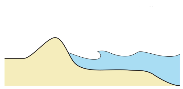
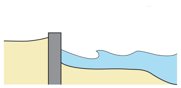
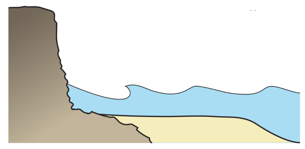
Coast types
| Sandy beach | Beach backed by structure | Beach backed by cliff |
|---|---|---|
|
|
|
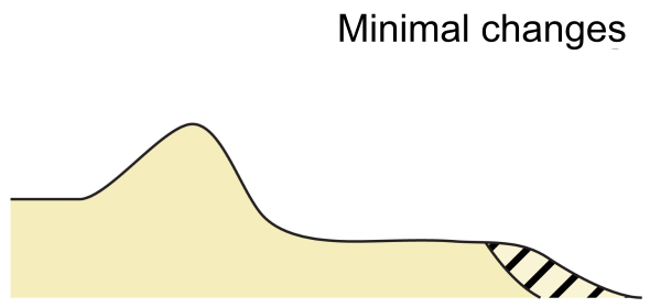
Beach erosion hazards
| Category | Description | Diagram |
|---|---|---|
| Minimal changes | Minimal beach changes |
|
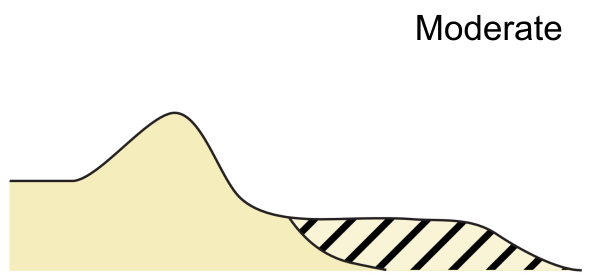
| Moderate | Moderate erosion, associated with a 0.2-year ARI wave energy event |
|
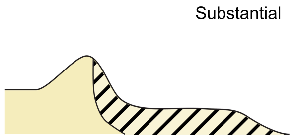
| Substantial | Substantial erosion, associated with a 2-year ARI wave energy event |
|
| Extreme | Extreme erosion, associated with a 10-year ARI wave energy event |

|
Coastal flooding hazards
| Category | Description | Diagram |
|---|---|---|
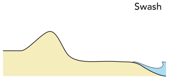
| Swash | Total water level does not reach the dune toe and is confined to the beach area |
|
| Collision | Total water level is impacting the dune face |

|
| Overwash | Total water level overtops the dune crest |

|
| Inundation | Total water level completely submerges the dune |

|
Wave and storm surge forecasts
16-day wave forecasts are based on the National Oceanic and Atmospheric Administration (NOAA) operational wave forecast system WAVEWATCH III® . This forecast has been extended to include more detailed information at the coast. For further details see NOAA WAVEWATCH III Model Description. Storm surge forecasts are based on real-time observations from coastal tide gauges.